
GeoData Explorer
Manual & FAQ’s

JSON Catalog
We have JSON Catalog(s) and Catalog Editor ToolBasically, think of it as projects and your GIS project with all the ...
Label Features
Label vector data - select a field (key/column) and it will be labeled.In addition the map supports clicking on features ...
Screen Size and Orientation
The app transforms and is flexible to work with Desktop,Laptops and Tablets of any screen size, resolution and pixel density ...
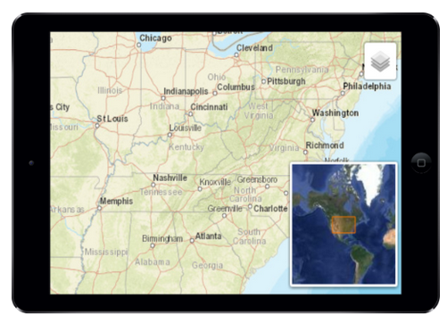
Overview MiniMap
OverView MiniMap - Shows where you are when your zoomed in and allows you to keep your frame of reference ...
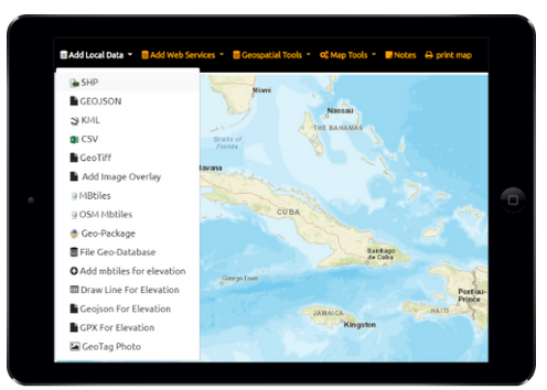
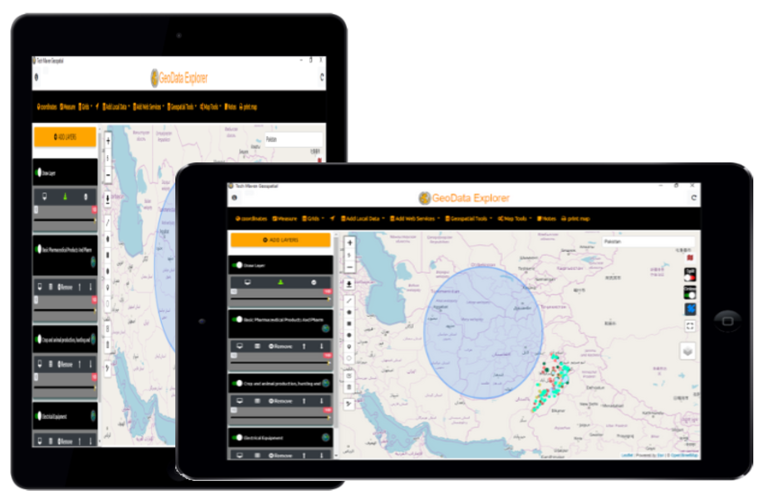
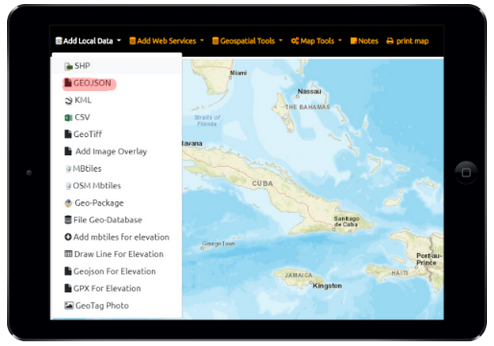
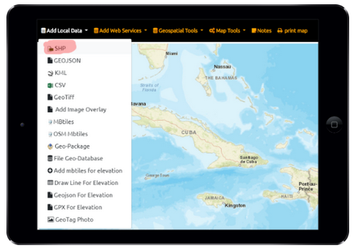
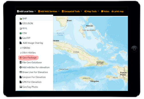
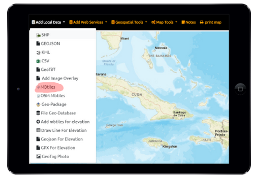
Local Data
GeoData Explorer - local offline disconnected vector data supported ...
Tiling of vector data
Tiling of large vector data GeoData Explorer automatically breaks up large GeoJSON and Shapefiles into 256x256 pixel vector JSON tiles ...
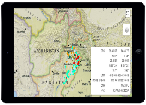
Coordinates
View Location Coordinates in multiple formats latitude and longitude in Degrees Minutes Seconds and Decimal Degrees Maidenhead Locator System (QTH ...
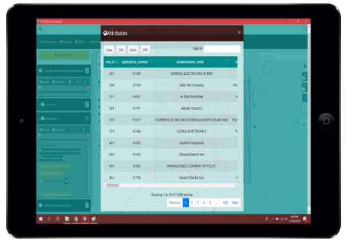
Attribute Table and Export
View Attribute Table of all vector datasets and drawing data. View up to 1,000 records and filter and sort Export ...
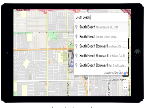
Place Search and Geocoding and Directions
Google Places and Address Geocoding and Routing/Directions ...
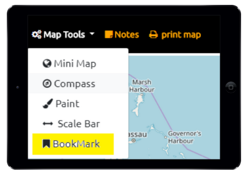
Spatial Bookmarks
Spatial Bookmarks quickly zoom to a particular area or extent ...
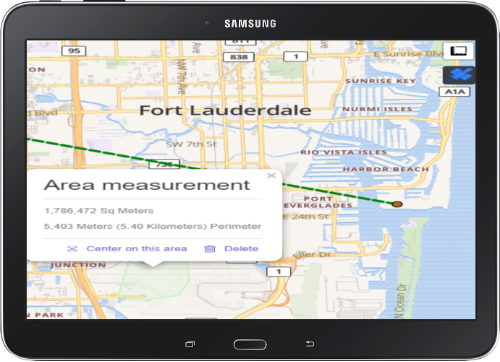
Measure Tools
Measure length and area measurements ...
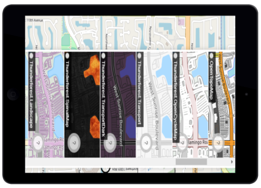
Basemap Picker
Basemap Picker - online internet connected tile servers preconfigured for quick display of basemaps. Quick Basesmaps - No Preview Thumbnail ...
OSM Vector Tiles
Open Street Map Vector Tiles from OpenMapTiles.org/.com offline mbtiles are supported with built in GL JSON Stylesheet support with multiple styles ...
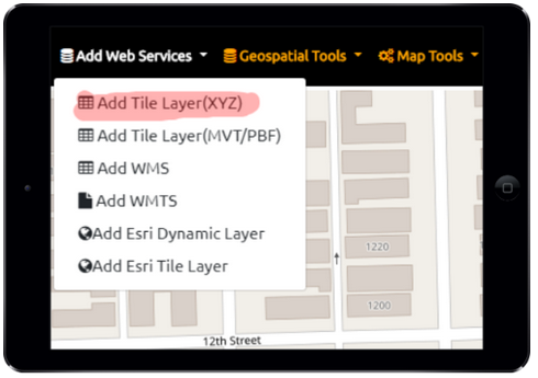
Raster Tile Server (XYZ or TMS)
We support Tile Servers with Schema XYZ and TMS XYZ is top left origin and TMS is bottom left origin ...
ESRI Shapefile
Zipped ESRI Shapefile in Unprojected Coordinates EPSG:4326 Geographic WGS84 Supports viewing Geometry (Points, Lines or Polygon) and Attributes from One ...
View Offline Raster Tiles (MBTILES/GPKG)
Raster Tiles from a Tile Server (XYZ or TMS) and WMTS are supported Images can be PNG, JPG, WebP or ...
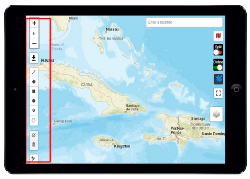
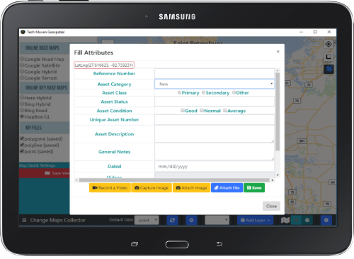
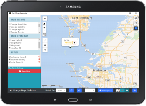
Collect Feature Data
Collect Feature Data - Points, Linestring, Polygon with attributes and media Draw Polyline Linestring Draw Polygon, Circle, Rectangle Point Marker ...
Frequently Asked Questions:
What Coordinate Reference System /Projection is supported for Vector Data?
ESRI Shapefile, FileGDB, GeoJSON and GPKG all must be in unprojected Geographic WGS84 (EPSG:4326)
GEOGCS["GCS_WGS_1984",DATUM["D_WGS_1984",SPHEROID["WGS_1984",6378137,298.257223563]],PRIMEM["Greenwich",0],UNIT["Degree",0.017453292519943295]]

Vector Tiles must be in Google Spherical Web Mercator Projection /Auxillary Web Sphere (EPSG:38567)
What Coordinate Reference System /Projection is supported for Raster Tiles?
Raster Tiles (Offline and Online) need to be in EPSG:3857 Google Spherical Web Mercator/Auxillary Web Sphere/Pseudo-Mercator. This is to keep the data consistent with other data sources and online base maps. Having to reproject tiled data causes a lot of overhead on mobile devices and tablets.
What format can I export my drawing and editing?
Currently, only GeoJSON format is supported. Click on the draw layer on the table of contents and click the downward facing arrow.
Does the app support offline spot elevation and terrain profile views?
Yes, if you’ve loaded mbtiles for elevation then as you move around the map you will see elevation readings.
The MBTILES have Terrarium Specification/Format PNG Tiles with elevation values encoded in the RGB Values of each Pixel
If you draw line for elevation, Load a GeoJSON or GPX file for Elevation you will see Graph/Chart of the Terrain Profile View along that Line/Route
Can I add Labels to my features?
No, however, we are actively planning this feature. You can, however, get popup attributes by clicking on feature. Currently, the only dataset that supports labels is OSM MBTILES
Can I build custom forms and predefined field types?
Not at this point. We have a full feature field data collection application with rich flexible forms that can capture points, lines, and polygons Orange Maps Collector
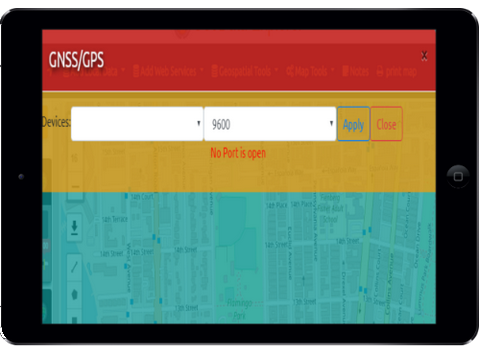
Can the app work with a Windows Laptop/Tablet with Internal GNSS/GPS?
Currently, NO we are actively working on adding Location Sensors as Windows calls them. You must have an external GNSS Receiver.
We support any NMEA compatible GNSS Receiver and we let you specify the COMM Port and Baud Rate.